
HIKING GOLDEN EARS PART 2
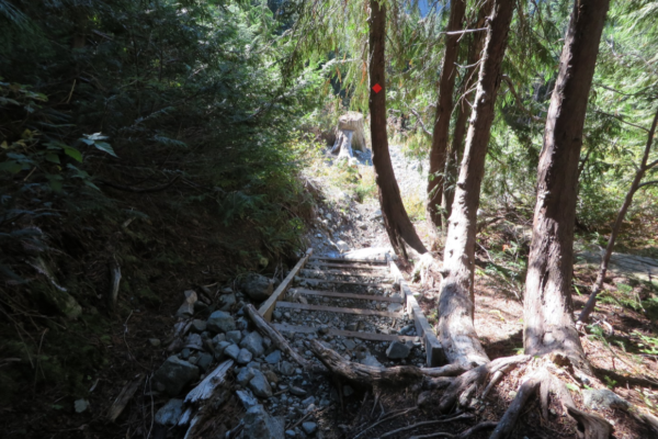 The first of the rubble-filled stairs which led us up into the forested slope below the ridge.
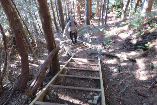 Soon there was another stair, but these soon were over, even though we could have used many more, given the steepness of the trail in places.
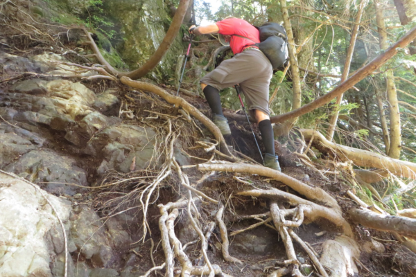 Soon there was another stair, but these soon were over, even though we could have used many more, given the steepness of the trail in places.
Thursday Sept 22nd, 2016, Continued
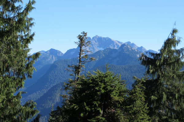
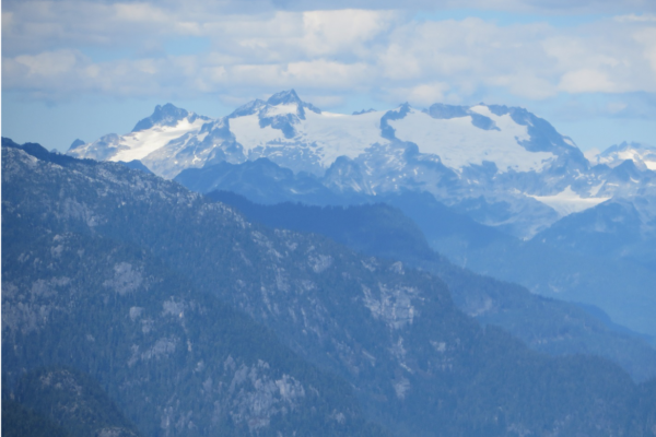
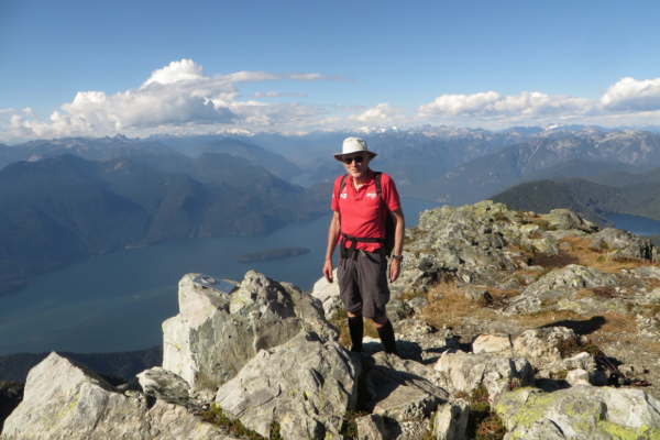
The summit we were aiming for stands at 1,716 m (5,630 ft). The origin of its peculiar name is shrouded in mystery, but apparently the name comes from Golden Eyries. This relates to Golden eagles that were observed near the summit in the past. However, the mountain does have twin peaks, and was therefore thought to resemble a pair of ears by some in the past as well. Whatever the case may be, the name of Golden Ears now seems firmly established.
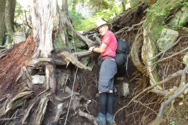
We started up a very rough staircase that had thoughtfully been placed on a very steep section of the trail where it left our rest area near the old cedar stump.
Shortly after we got on the ridge, we found a young couple with a tent. We were impressed. The climb was hard enough with a day pack, but they had carried up a tent and all the necessary supplies to camp there. Later on, they passed us on their way to the Golden Ears. They were moving fast and we never saw them again, so we don’t know if they summited.
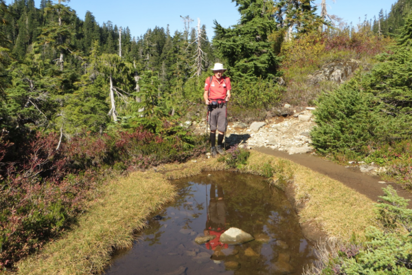
The distances were not great, but progress on the rough trail was slow. The distance through the steep forest from the first rubble-retaining stairs to the ridge was only 1.5 kilometers. The walk along Panorama Ridge to the Emergency Shelter, a major landmark, was only another 1.7 kilometers. However, we eventually had lunch on the ridge, and carried on without having reached the shelter. In fact, there was no sign of it, until at one point we rounded a high rocky shoulder, and suddenly there it was. We knew then that we were about to start our final ascent. It was a good thing, as time was getting on, and the days are not so long in the last half of September.
We took the opportunity to explore the shelter. It consisted of a main floor, and a ladder which led up to a small loft. The loft was quite small and would not provide much sleeping room.
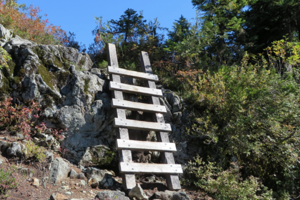 This very sturdy ladder was one of the few assistive devices on the trail. Interestingly, even though we were going up to the Golden Ears, we had to descend this ladder to get there.
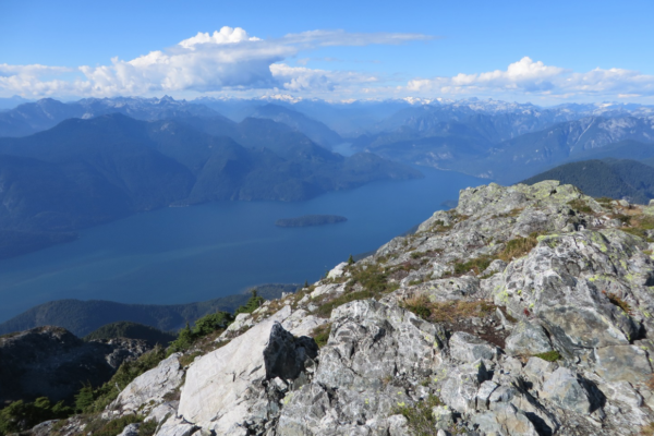
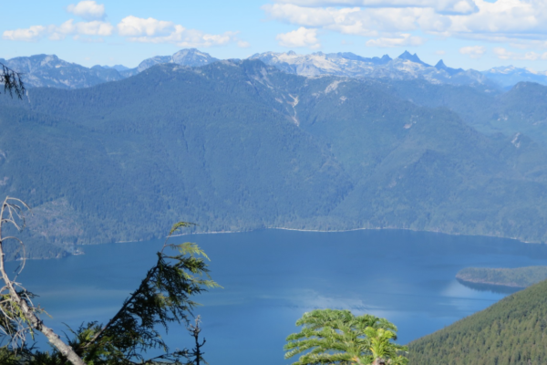
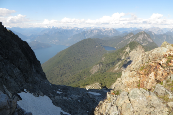
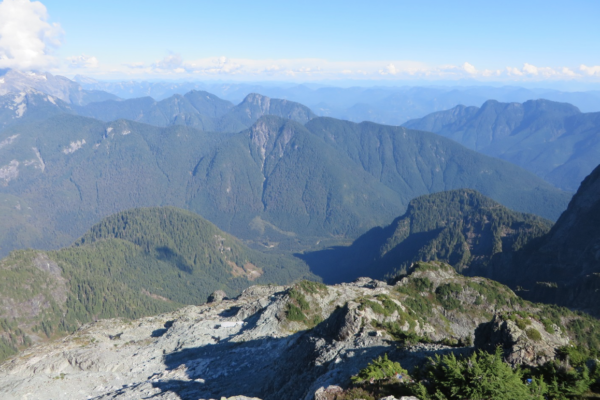
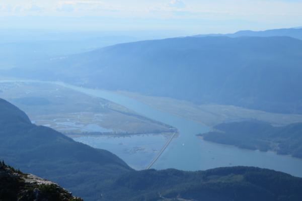
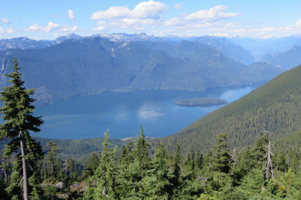 The views of Pitt Lake became ever more beautiful as we progressed along the trail. The island in the lake, Goose Island, added interest to the scene.
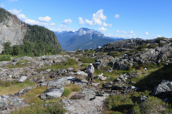 Eventually we came out on a rocky ridge with splendid views.
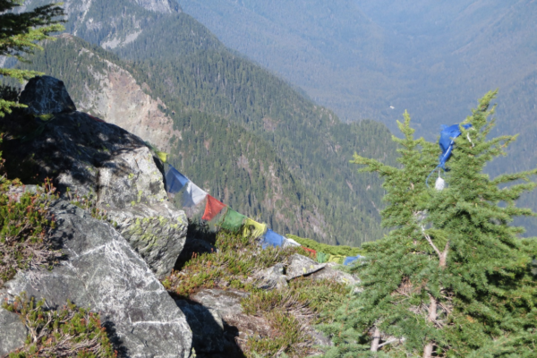
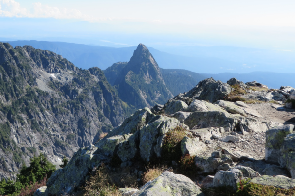
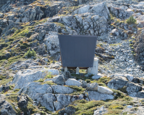 Our first view of the emergency shelter, with its “hanger on” toilet. We were now far beyond our turn-around point of the previous year, but there was still some distance to go. It is said to be only one kilometer from the emergency shelter to the north Ear, but that kilometer seemed largely vertical.
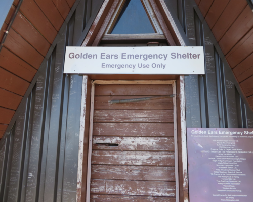 The shelter was not meant to be a hiking hut. However, on the way up the trail we had met a lone female hiker coming down off the mountain who has spent the previous night there, presumably with a pre-meditated stay.
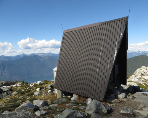 The emergency shelter had quite a picturesque location on the ridge.
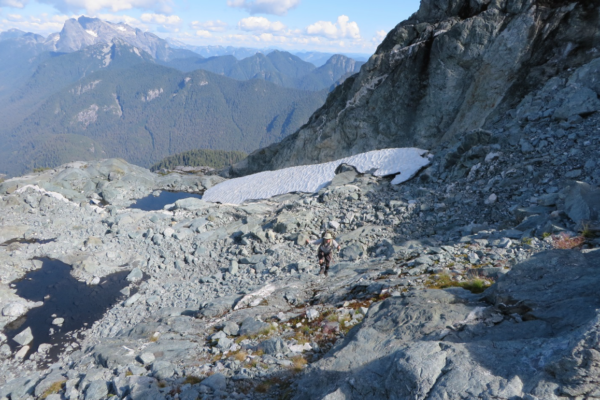
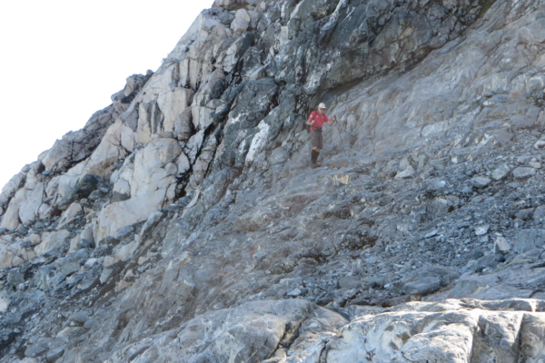
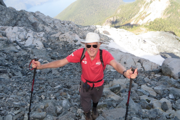
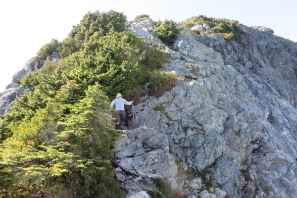
Golden Ears Mountain was very rocky once we were past the hut. The climb was gradual at first, and then it became quite steep. Although there were some cairns and some ribbons, the way up was not at all obvious. When it became too steep in one direction, we decided to try another and went around a rocky shoulder and tried the front side of the mountain. As we ascended above a small snowfield, we saw two hikers above us. They told us they were taking a different route down from the one they had come up on as their previous route was too steep. They were glad to see us coming up, as obviously when they reached our position, they would be able to continue without any insurmountable obstacles, seeing that we had made it this far. From our point of view, we were glad to meet them too for now we too knew that by following where they had come down, we would be able to make it to the top. After exchanging a few pleasantries, during which there was a discussion of my advanced age of 71, we all moved on.
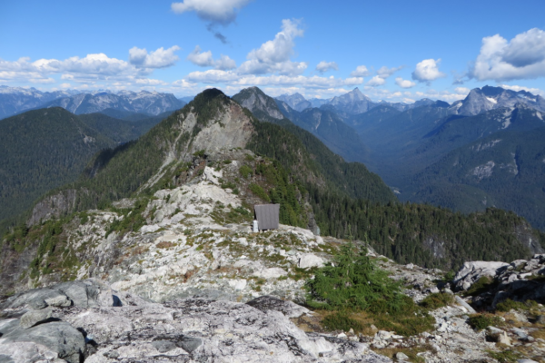 As we ascended further up the mountain, the hut receded behind us.
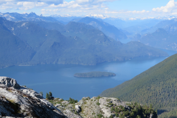 As we ascended, we had ever more beautiful views of Pitt Lake and Goose Island.
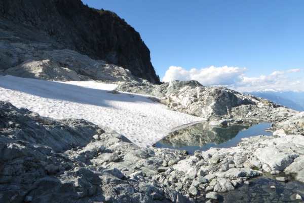 There was still a small snowfield or two on Golden Ears, where once there had apparently been a large permanent one. This snowfield had a small reflection pool at its base.
Shortly after leaving the peak, we had a little misstep, which we hoped would not be an omen of things to come. Not far below the peak, we had to go through a “tunnel” in some dense brush. Somehow we got into the wrong tunnel, and after descending very steeply for a few minutes, we realized we were going to the wrong side of the mountain. We had to claw our way upwards and start again.
End of part 2